 The National Park covers 1,438 km2 (555 sq. miles) with over 2,500 km of public rights of way. The National park offers a wide range of walking experiences from the gentle and tranquil walks along Dovedale with the famous stepping-stones across the river and majestic Thorpe Cloud to the bleak challenge of the high areas such as Kinder Scout and Bleaklow. The Park is roughly made up of the White Peak area in the south and the Dark Peak area towards the north, so named after the colour of main rock types in these areas (Limestone for the White Peak and Gritstone and Shale for the Dark Peak area) With good road links from most of the surrounding urban areas and some stunning scenery the Peak district is very popular offering some good shopping in Buxton, Matlock and Ashbourne, water sports at Carsington Water and some of the best climbing in the UK in areas such as the Roaches and Windgather Pass. Areas well worth a visit are Dovedale, Thor's Cave, the Roaches and Kinder Scout but there are many others less well known also well worth a visit. For the less vigorous walker the Peaks offers stunning views and gentle walks with only the northern areas of Kinder Scout and Bleaklow being for the more serious walker so it is a good area to learn skills on before progressing to the more challenging National Parks such as Snowdonia or the Lake District.
Our first walk in the Peak District is a climb up to Lose Hill, a spectacular viewpoint near Castleton.
Our second walk takes us onto Kinder Scout.
The Peak District is covered by two Explorer maps
![]() EX001 Peak District Dark Peak , includes Kinder and Bleaklow.
EX001 Peak District Dark Peak , includes Kinder and Bleaklow.
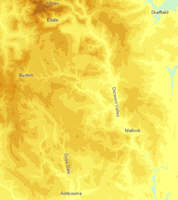
![]() EX024 Peak District White Peak, includes Matlock, Buxton and Bakewell.
EX024 Peak District White Peak, includes Matlock, Buxton and Bakewell.